In Part One of this article, we travelled from Picton and discovered the Eastern half of the North of the South Island, leaving you at Marahau, the gateway to the Abel Tasman National Park.
In part two, we continue into Golden Bay and travel as far as we can drive down the West Coast, exploring plenty of fun things to do on the way.
Perhaps surprisingly, and contrary to popular belief, Golden Bay is not called Golden because of the colour of its beaches but rather after the precious metal that was discovered there. It’s a special place and very, very laid back. Part of this is due to its relative remoteness and the fact that there is only one road in and out and that’s over Takaka Hill, which is actually a small mountain.
It’s worth looking into the geology of the area, which is fascinating. At the top of the hill is the deepest sink hole in New Zealand, known as Howard’s Hole. It’s over 300m deep and can be reached by a short walk from the car park at Cannan Downs. Well worth the walk.
Before heading up the hill, take a branch to the left at the bottom of the hill and take a look at the Riwaka Resurgence. Rain falls on the hill and disappears down sink holes, is held and filtered in the mountain before appearing seven years later at the Riwaka Resurgence and becoming the Riwaka River. Again, it’s a short walk from the car park and it’s well worth it to see the river literally coming out of the small cliff.
We mentioned Howard’s Hole earlier. This is very popular with cavers and friends of mine have seen people, who had entered Howard’s Hole, exiting the cave system at the Resurgence. Definitely not for the claustrophobic!
From the top of the hill, the views over Golden Bay and the Abel Tasman are amazing, particularly at sunrise.
The next place, and an absolute favourite of ours, is the Anatoki Salmon farm. This is brilliant for everyone. There’s a small lake full of salmon that you can catch yourself. Everything is provided and, once you’ve caught what you want, you can take it to be prepared and smoked and eat it with a glass of wine in the café or take it away. It is simply delicious and obviously as fresh as it can get. Don’t get carried away though. You pay for everything that you catch, and it can quite quickly add up, especially if everyone wants to catch one. You’re not allowed to throw back what you don’t want.
There are also tame wild eels, pigs and llamas for the kids to pet. Maybe not the llamas, but definitely the pigs.
A little known but fabulous camp destination is the Cobb Reservoir. Turn left just before Upper Takaka and take the well-maintained track to the dam and then onto the end of the lake to camp. Despite being an easy drive in, the sense of remoteness is fantastic. There’s plenty of room and it’s seldom busy.
Where the Cobb River enters the lake is a great spot to fish. Last time, we only caught small trout, but got one with nearly every cast. Great fun!
A slight drawback is that dogs are not allowed.
As you continue towards Takaka, you pass Paynes Ford. This an excellent spot for swimming and hidden in the forest is a long rocky outcrop with tens of rock climbing and bouldering routes. Most of the climbs are bolted and the grades vary from beginner to expert. I’ve done some climbing here and its worth a diversion if you’re into climbing or just to watch the many climbers doing their thing.
Takaka township is so laid back, it’s almost horizontal. There is a supermarket and fuel station along with quirky shops and cafes. There is a market in the summer on Saturdays. It’s definitely worth a visit. A friend of mine used to live there and managed the cinema. It’s small and cute with sofas and comfy chairs to sit on.
It also has a dairy that opens on Christmas day.
Beyond Takaka, you come to Te Waikoropupu or Pupu Springs. This is a natural feature similar to the Riwaka Resurgence. It consists of a small, spring fed lake with crystal clear water. It is now “Tapu” and any contact with the water is forbidden.
Before it became Tapu, it was a popular diving location as the water was renown to be the clearest in the world, with visibility of up to 80m.
It was also a gold mining site and there is a circular route that you can walk where the canals and water diversions are still visible. Quick tip: if you only want to see the springs themselves, walk the track in the opposite direction to the signage. It’s only a very short walk to the springs, maybe a kilometre or so and flat. There are several toilets on site.
Swimming is not allowed at the springs, but on the way out, turn right at the main road, go over the bridge and right again down onto a gravel beach by the river. This is the same water that came out of the springs and just as clear. It’s also just as cold: 11.7°C all year round.
Continuing to head West towards Collingwood, you will find Patons Rock on your right. Head down to the beach where there are the remains of an old jetty.
From here there’s a great view of Farewell Spit, named so as it was the last sight of New Zealand that Captain Cook had on his voyage in 1770, before heading to Australia. It is also the northernmost point of the South Island, about 100km north of Wellington. At the end of the spit, you can just make out some palm trees. Apparently the lighthouse keepers used to take soil out to the end of the spit and planted the palms that we can see today.
Further up the road is the quirky Mussel Inn. This is a pub and micro-brewery constructed entirely out of recycled materials with a huge wooden table and a post covered in mobile phones, which have been nailed to it. Sends a clear message.
The food and beer are excellent. If you’re not sure what you want to order, you can try a taster paddle with six different beers.
Collingwood is a great little town with a variety of shops. It could have become New Zealand’s capital, but in 1864 three Australian commissioners were tasked with recommending a more central location for the capital . They did visit Golden Bay (then still known as Massacre Bay) but their recommendation was Wellington.
Carrying on and past Port Puponga, you get to the famous Wharariki beach with its equally famous Archway Island. If you haven’t heard of it, don’t worry. Once you’ve been there, you will start noticing it on calendars everywhere. There is a small seal colony and, if you go at the right time of year, you will see seal pups sunbathing and playing in the rocks.
There is also a cool café adjacent to the car park with hammocks to relax in. The walk to the beach is short and well worth it.
Some of you who know the area will probably be now thinking, this is in a 4WD magazine and he’s missed the Aorere Goldfields. Don’t worry, I haven’t, I’m saving them for the return journey and the “grand finale”.
Take the road back to Port Puponga and turn right at Seaford towards Anatori. This is a beautiful scenic gravel road taking you along the Whanganui inlet with many viaducts and spectacular rock formations. Continue until you reach the Anatori River and a small campsite.
This is a great place to camp. Depending on the fire risk, you can normally light a campfire if not at the campsite, then on the beach. There is usually plenty of driftwood around to get a fire going.
Being the West Coast, the sunsets are as impressive as the sandflies, so take plenty of repellent and enjoy the view.
You’re nearly as far South as you can drive on the West Coast. There was some talk at one stage of building a road to link up with Karamea, but this hasn’t happened and, having walked the Heaphy Track, the devastation to the Kahurangi National Park and its pristine beaches would be unforgivable.
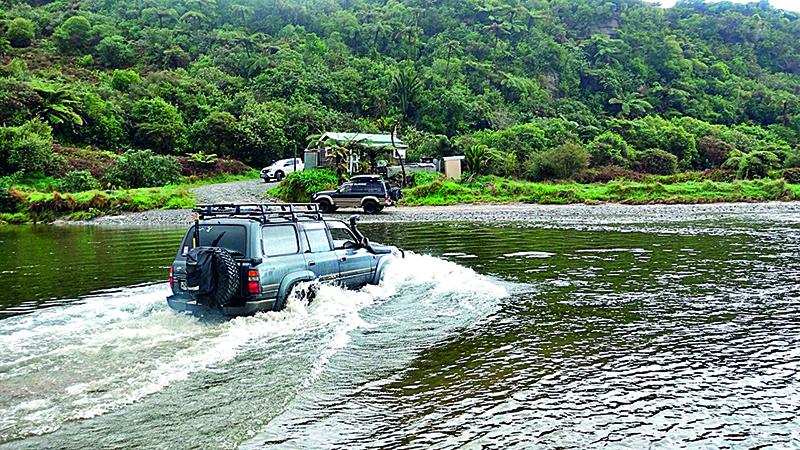
The only obstacle in your way between there and the end of the road is the Anatori River. This looks benign, but has caught many people out. Check the tides and don’t attempt to cross when the tide is high. The base can be soft and it’s easy to underestimate the depth.
Once across, continue down to the Turimawiwi River and the massive sand dunes. This is a really cool spot and you can just see the Kahurangi Lighthouse in the distance. It is possible to drive to the lighthouse, however the tides have to be right and it’s a multi vehicle undertaking, not without risk.
On the way back, visit the Aorere Goldfields. There is a great 4WD track with some tricky sections, made more tricky in the wet. If your passengers are a bit nervous, some of the more “challenging” sections have an easy bypass option. There are short and long walks to do as well as caves to discover. Make sure that your head torch is fully charged and that everyone in your group has what they need. Remember that it will be colder in the caves than outside, so wrap up.
Have a look at Jono Hitchcox’s excellent video to see what to expect. Google 4x4monthlyNZ, Operation Overland 2023 and watch “Day 2”. So there you have it. An epic overlanding trip traversing the whole of the top of the South Island packed with plenty of history, fun things for everyone to enjoy and great scenery.
If this is something that you would like to do with a guide and a bunch of like-minded people, get in touch and let us know.
Email rich@4x4exploreradventures.co.nz.
Images and words by Richard Soult. Part two.

