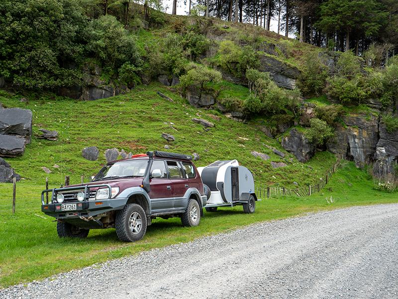
This year we decided to take advantage of the Christmas break to explore the region around New Plymouth – an area that is not really far enough away to be a big holiday destination but too far for a quick weekend trip. We booked five days camping at Oakura as a starting point, with further plans to be decided later. While Ashley and Gillian were well settled into sleeping in their converted 4WD people mover, this was the first major shakedown trip in the K-Pod – the teardrop-style mini-caravan replacement for our very well used 2-person tent.
The trip up from Wellington showed the K-Pod to be easy to tow, had much less impact on our fuel usage than it did when I first brought it back from Tauranga – I think that the brakes had settled in and stopped dragging – and was easy to manoeuvre into our cam site. Even without having power on the site, we were well set up with power for the lighting and water pump supplied from the lithium battery in the car, and a small gas cooker in the kitchen. While we were very comfortable sleeping in it, neither of us is large and I suspect that anyone over average size may find the sleeping platform a little short. With the K-Pod set up and getting a big tick after our first night, we had a rest day exploring New Plymouth and getting used to the heat before our first backroad trip.
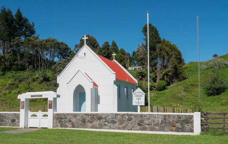
We had planned what we thought would be a shortish route that would take us north of New Plymouth and get us back to camp by mid-afternoon. Leaving about 9:30 we headed up SH3 before turning off at Uruti and stopping for a look at the very picturesque and well-maintained Uruti All Saints Church. We continued on Uruti Rd through scenic farmland with some interesting rock strata and views of hills scarred with old, and not-so-old slips before climbing up into the ranges and through a rough-cut, unlit, single-lane tunnel to the next valley. After the bright sun, the driving lights and light bar provided some much-needed extra light through this narrow tunnel and I was glad I wasn’t driving anything bigger.
Although our return route was along the ridge via Kaka Rd, we first wanted to explore the two dead end roads at the end of the valley. Our first stop was at a rather unexpected sign in a roadside paddock, giving the history of the local school (Pehu School) and an interesting insight into how isolated this area was a hundred years ago. Working our way up the valley on the unsealed road, May was struck by contrast between the rich green grass on the hillside and the bare, almost silver trees that had apparently been poisoned as part of the farm’s land management. Finally, we reached a nice shady clearing where the road crossed the stream through an open gate. There was no sign indicating private property, and the road was not shown as gated on the topo map, so we continued on for about a kilometre to see if there was somewhere better than the shady area we had passed to stop for morning coffee. However, with few fences and stock on the road we were not sure that we were still on a public road, so decided to return to the bridge for our break. While we were relaxing, we saw a ute with beehives on the back come over the bridge so I asked whether the road was public or not. Apparently the public road did continue, stopping at a farm gate a few hundred metres beyond where we had turned around, but I was told that there was no shelter there and we were in the best place for our break.
With that question cleared up, we returned to the side road we had passed on the way up the valley. This started off as an easy run up a valley before a right turn where we started climbing steeply. I ended up in low range 4WD to cope with the steepness, potholes and some broken seal on the very steepest sections. While this was not too much of a challenge, we also started passing washouts, some of which had taken out part of the road, with very long, steep drops into the valley below. We finally reached the top of the ridge with amazing views that we stopped briefly to enjoy before starting the descent back down into the valley. However, we had barely started down when we came to a washout that had taken out half the road. The map showed that the road only continued another few hundred metres so, with a good turning area before the washout, we decided to call it quits and head back to Kaka Rd.
Kaka Rd took us back up onto the ridgeline with some more clear views of Mt Taranaki in the distance before dropping back down into a valley. We passed an old Land Rover on the side of the road in a condition that would make fans of the marque either cry or want to buy it for a restoration project. I then started noticing clusters of Land Rovers of various models abandoned in sheep paddocks, but I never did find out why there were so many of them in this one remote area. Kaka Rd had two dead-end forks we wanted to explore, with a place for lunch high on our priorities. The first, shorter, road was an interesting run but with no good rest area for lunch. The longer option was Piko Rd, which we followed, enjoying the attractive scenery but no sign of anywhere to pull off and set up for lunch. Approaching the gate, we had all but given up on lunch when we saw that there was a perfect spot in the turn-around area in front of the gate. Lunch under an awning, with a nearby stream and plenty of bird life was a very welcome break.
By the time we had finished lunch it was later than we had planned, so we returned to Kaka Rd and followed it back to SH3 with no further detours. From there it was an easy run back to camp, arriving only three hours later than we planned. Overall a very successful first day of touring, with more trips planned for the next few days.

