This month David Coxon finds a remote loop west of Whanganui that looks too interesting to ignore.
Our solo vehicle trip started when we turned off SH1 just north of Bulls, passing straight through Marton and heading into the hills, accompanied by lowering clouds. Our route took us in an arc into the hills then back down towards the coast, ending up in Whanganui, our stop for the night.
With a mixture of sealed and easy gravel roads, this was a very pleasant and scenic route that nicely filled in the afternoon, taking about three times as long as the direct route to Whanganui.
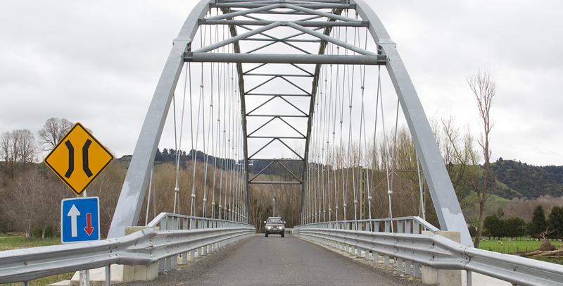
On a good afternoon there would have been many stops for photographs of the early spring countryside, but unfortunately the clouds were low and heavy, giving gloomy, flat lighting that made good photographs a lost cause. Apart from a few record photos, the only subject of interest was a rather dramatic bridge that we found at the turnoff up the Whangaehu River valley.
Of course, as soon as I tried to get photos of the Prado on the bridge, the previously empty road was suddenly full of vehicles all heading across the bridge and up the valley. With the bridge photos taken, the generally gloomy conditions encouraged us to mark this as an area to revisit in better weather, and head straight to Whanganui and hope for sunnier weather the next day.
Our hopes were realised the next morning when the day dawned fine and warm. We left Whanganui, following Sommes Parade along the Whanganui River before it branched into the Kauarapaoa Stream which we continued to follow, stopping a few times to photograph the valley from the bank.
Oops…
The third time I did this was on a narrow section of the road so I pulled well over for safety, and promptly slid into the very soft drainage ditch. Even with both diff lockers engaged and all four wheels turning I was going nowhere, and the freedom of being on our own suddenly became a lot less attractive.
My first thought was to winch out, but there was nothing around to winch off. I thought of letting the driver’s side tyres down and hope that that would give me enough traction, then I remembered that I was carrying a set of Tred recovery boards that I had got for sand recoveries and never needed to use.
Although really designed for use when bogged in sand I thought that they might work to give the driver’s wheels something to grip, so I wedged them under the driver’s side wheels, with the front one aiming slightly up onto the road and gently eased forward, following the angle of the front Tred. I was amazed at how easily the tyres gripped the Treds and guided me far enough out of the ditch for one front wheel to reach the sealed road and pull me the rest of the way out. With the crisis averted, I realised that I had not taken a single photo of my situation, but May was adamant that we were not going to get stuck again for the camera.
As we progressed up the valley the road became narrower and obviously less well used, with towering cliffs on one side and steep drops on the other, and even grass growing in the centre in some places. I started thinking of all the other ‘through roads’ on the topo map that ended up being paper roads across a gated paddock. Was I about to find a gate across the road?
Watercress
When May spotted some untouched watercress growing on the side of the road it was time for a harvesting stop and an opportunity for me to enjoy a totally- peaceful coffee while May harvested.
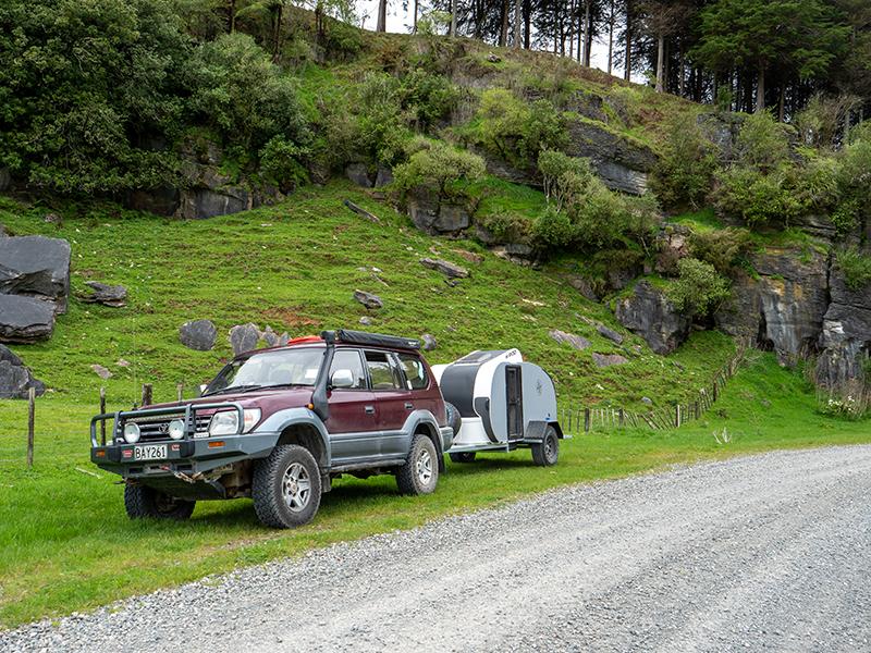
Back on the road and not much further up the valley, my concerns of coming to a locked gate were eased when we stopped to photograph an old shed and I spotted a pair of very faded old signs pointing both the way we were going and where we had come from, both saying “Wanganui” – obviously pre-dating the name change.
Soon after this we reached the high point at the far end of the loop at the Kauarapaoa Scenic Reserve and started dropping back down towards Whanganui. As we moved from a valley of farmland and native bush to one based on forestry, the road improved dramatically as did our speed.
With lunch now high on the agenda, the only interruption on our run to lunch was a quick stop to photograph an old bus. While we had planned to stop in a suitable clearing for lunch, the lack of pleasant clearings and the heavy cloud that was hanging on the hills led to a change of plans, with lunch being a detour to the Kai Iwi beach where there was a very nicely laid out day picnic area at the mouth of the Mowhanau stream.
Unfortunately, although we had got away from the threatening clouds over the hills, it was still cold and windy, meaning lunch was eaten sheltering in the car. Our final run for the day was to return to our planned route and take a few back roads parallel to SH3 for the final run into Whanganui, ending up back on Sommes Parade and the end of another memorable adventure.

