Last month we left David and his travelling companions on their backroad trip from Dannevirke to Porangahau waiting for a large flock of sheep to clear the road.
By the time we were ready to move on the sheep were safely in their new paddock, giving us a clear run for the remainder of Maunga Rd, with a short run on a sealed road to Te Uri Rd, where we continued our backroad run to the coast.
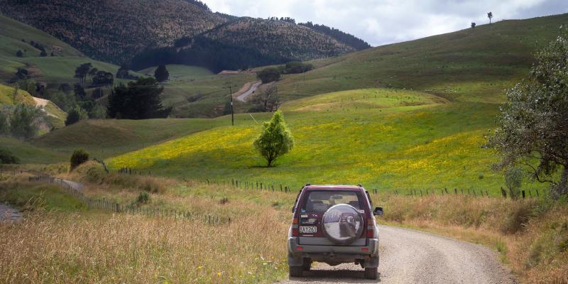
Initially sealed, Te Uri Rd soon changed to a very high quality and well-maintained gravel road as it worked its way through the hills with a mixture of farmland and pine plantation. As we crossed a council boundary, however, the road immediately changed from smooth and well maintained to narrow, worn and rutted, creating an experience much more in keeping with the sense of remote adventure as we continued our way through a mix of farm land and pine forest.
Once out of the ranges the road straightened out and it was an easy run to the main road and on to Porangahau, with a short detour down to the beach just in time for a late lunch.
A pleasant affair
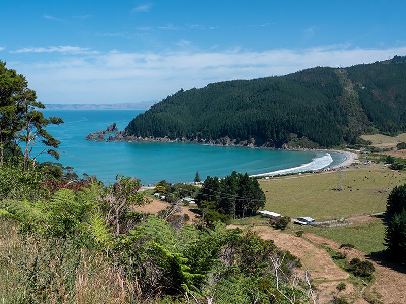
Lunch was a very pleasant and welcome affair, parked on an almost totally empty beach, enjoying the sun and fresh air, and with the opportunity for a quick play in the surf. Before leaving the Porangahau area we decided to head south to visit the little settlement of Whangaehu on the coast about half way between Porangahau and Cape Turnagain. This entailed a 15km gravel road drive over the coastal ranges and down into the Whangaehu River valley to reach Whangaehu, another relatively isolated and peaceful coastal settlement with a beautiful beach and coastal views that would cost millions to get in a major city. The beauty of New Zealand continuously amazes me.
Although it was too early for another coffee stop we enjoyed a walk along the beach, and I did some paddling to photograph the cliffs with the ripple of the incoming waves in the foreground, before heading back to Porangahau and taking more major roads back to SH2 at Waipukurau for a bit of retail therapy.
With the temperature in the high 20s an ice cream stop was also very welcome before the run back to Dannevirke and a cool beer in the grassy shade beside our waiting tents.
Final countdown
Day three dawned dry but cloudy with light rain threatening, suggesting a quick pack-up while the tents were still dry. All packed up and fed, we were off for our final day firstly heading for Weber via the main road. Just past Weber, on Route 52, we looped off into the hills through some back roads covering a mix of farmland and pine forestry plantations. Although some of the area was rather barren and the road a little rough following logging work, there were some nice views, especially as the sun started to break through the cloudy conditions.
At a “Y” intersection, where our road turned back to rejoin Route 52, we took the left fork to follow a lightly-used unsealed road through an older pine forest. This was a very pleasant and peaceful run with no sign that the road was used, except by explorers like us. We had stopped for morning tea on the side of the road, and were just relaxing, listening to the branches creaking overhead, when we head the sound of a large vehicle heading towards us. An unladen logging truck soon came into view, squeezing past us with a friendly wave from the driver, and presumably heading for the logging area we had passed earlier.
So much for relaxing on an unused track; I spent the rest of the run on high alert for another oncoming truck, although, luckily there were no more encounters. Finally rejoining Route 52, it was about a 15km run to Ti Tree Point, where we took another back road for a windy and dusty, but easy run to Akitio and lunch on the grass, once again overlooking the Pacific Ocean.
Time waits for no-one
With time moving on we chose to leave Akitio the same way we came in and take the sealed and most direct route back to Route 52. From there we followed the unsealed Horoeka Rd, successfully reaching Horoeka itself after a few momentary confusions with ‘Y’ intersections.
From here, we took the left fork up Towai Rd for a long twisty climb to the top of the Puketoi Ranges, with the conditions getting colder, bleaker and more windswept as we climbed. We finally reached the quarry on the ridgeline but abandoned any ideas of exploring it in the miserable conditions, and continued straight on own the other side, towards Coonor.
The road and the weather both slowly improved as we as we descended, until we finally reached the seal at Makuri in quite pleasant conditions. On the way we paused briefly at the Papanui Fall which, although worth the walk, was more of a chance to stretch our legs than a visual attraction.
From Makuri it was an easy sealed run through the Makuri Gorge, to follow the Makuri River out to Pahiatua and the end vof our trip.